"A resilient North Carolina is a state where our communities, economies, and ecosystems are better able to rebound, positively adapt to, and thrive amid changing conditions and challenges, including disasters and climate change; to maintain and improve quality of life, healthy growth, and durable systems; and to conserve resources for present and future generations."
— NC Climate Risk and Resilience Plan, Executive Summary
Applications
Select each application below to either enter the application or learn more details. You must be registered with a RAFT account to access the applications below. Some applications may require additional access permissions.
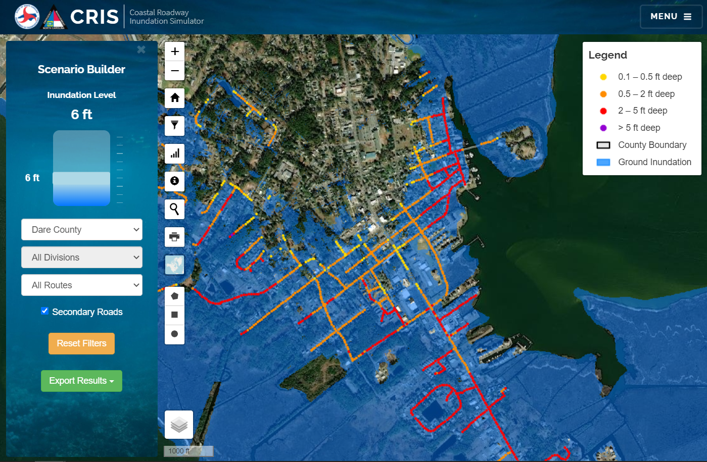
Coastal Roadway Inundation Simulator (CRIS)
CRIS allows transportation planners and emergency managers to simulate predicted roadway inundation from coastal flooding and quantify potential effects of inundation. Inundation boundaries are derived from NC QL2 LiDAR data and are available up to 15ft (NAVD88). Users can simulate flooding on both primary and secondary roads and export results to a KML for further visualization. Simulations are limited to coastal counties only.
Open Application
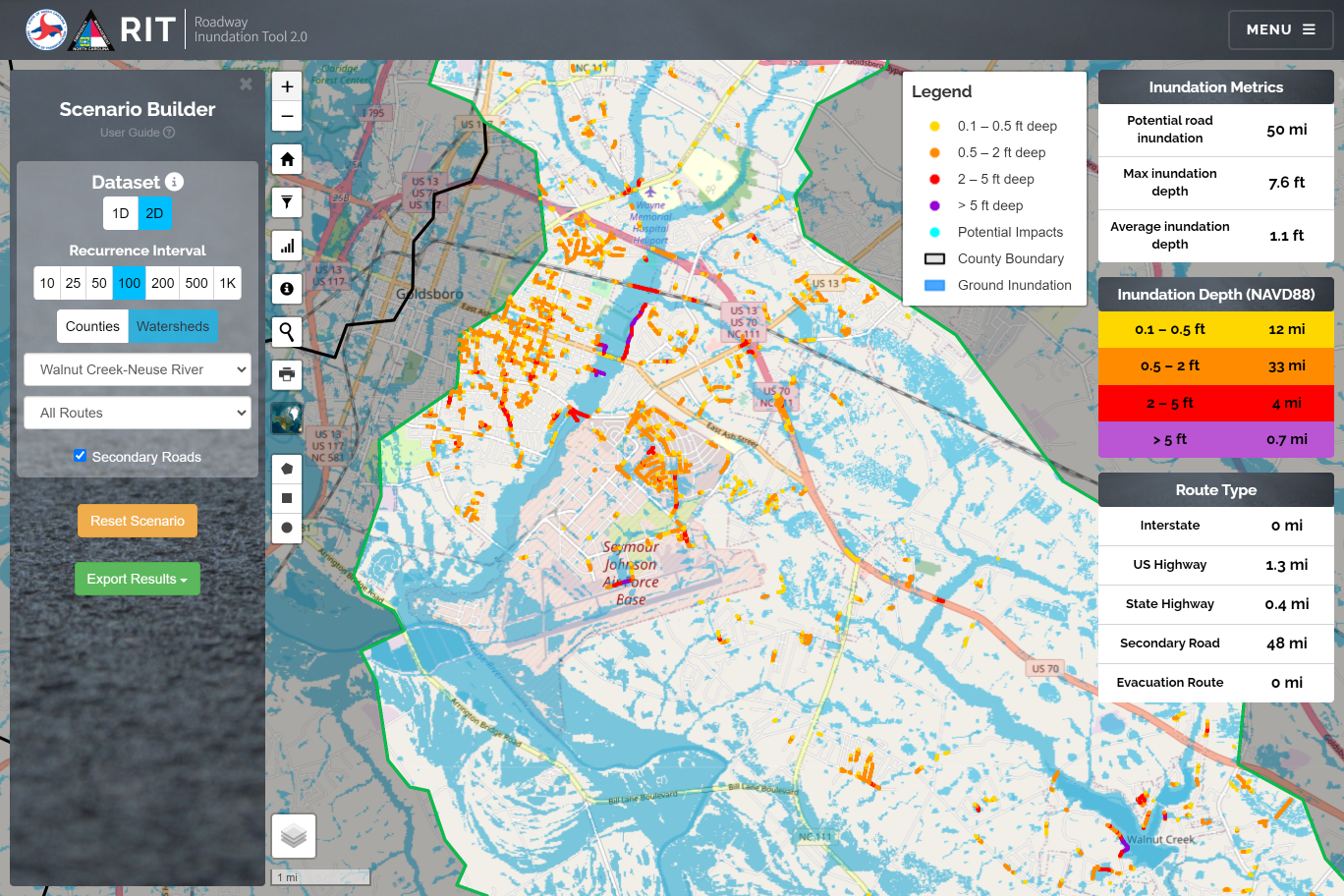
Roadway Inundation Tool 2.0
This tool provides a high-level overview of the potential inundation effects from river crossings along primary routes. Each crossing leverages detailed hydraulic model data provided by NCEM to show water surface elevations for the 10, 25, 50, 100, and 500yr flood frequencies. Available 2D data can also be displayed for 10, 25, 50, 100, 200, 500, and 1000-year intervals. This tool allows the user to see potential overtopping depths and flood effects at each primary road crossing and quantify potential effects.
Open Application